|
|
|
|
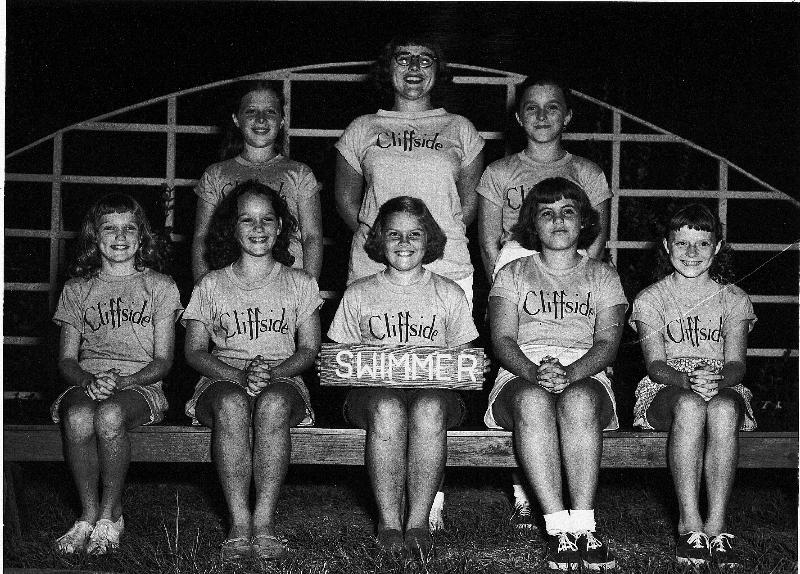
Cliffside 50s - Kay Pugh
in center with sign. Other names?

Clliffside Water Fountain in use -- on the stone sidewalk in front of cabin row. The Craft Shop is in the background, up the hill.
This is a picture taken later
in Cliffside's history; earlier (say in the 1950s), there was a simple
uncooled fountain at the top of a vertical pipe at this location.
In both cases, the water
taster very "iron-y".
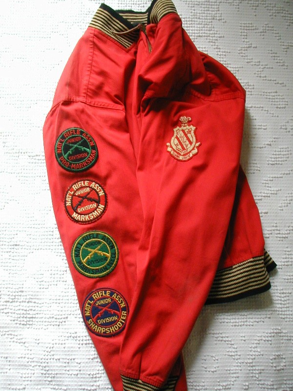
Many of us probably had such
a jacket -- in this case Ruth Lilley earned
riflery brassards at Cliffside
and followed up with the Elaine Award at
Carlisle (and followed that
up with Queen Guinevere in 1959!).
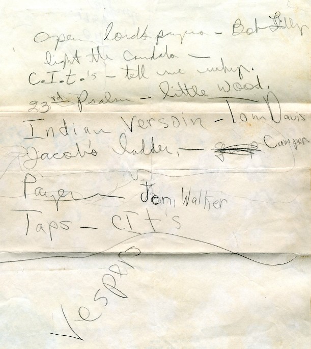
This is one of those scraps
of paper that somehow survived all the dangers of passing time...
The named people were CITs
at Cliffside in 1958 and were responsible for one of
the mid-session vespers
programs. Steve Casey jotted this program down (in a big hurry) one evening
in "The Hole", the lower
level of the CIT cabin behind the Craft Shop.
(The upper level was known
for a while as "The Nest".) Tom David, Bob Lilley and Jon Walker
all
partcipated, as did someone
known as "little Wood" -- Steve Smallwood, no doubt.
You'll recognize the songs;
"Tell Me Why," "We are Climbing Jacob's Ladder"
----------------------------------------------------------------------
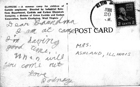
"Postcard from Camp"
"Rodney" writes to his family in 1961, on official Cliffside stationery...
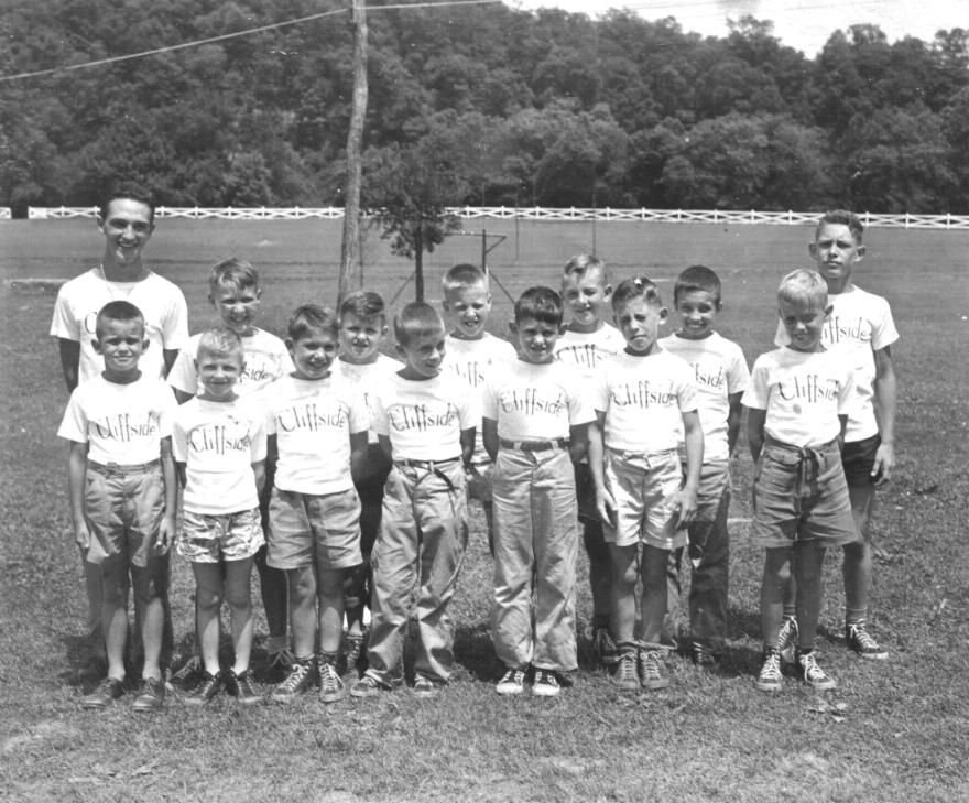
A cabin group at Cliffside about 1948. See any familiar faces?
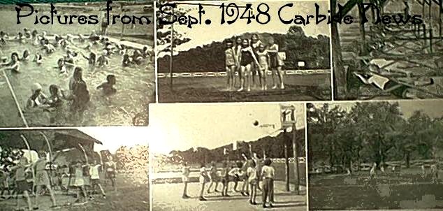
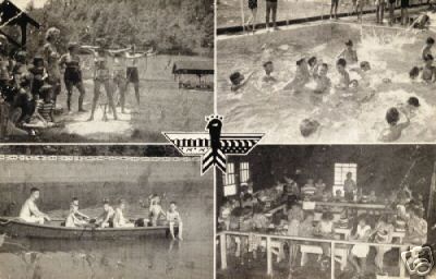
Some pictures from a 1948 "Carbide News"
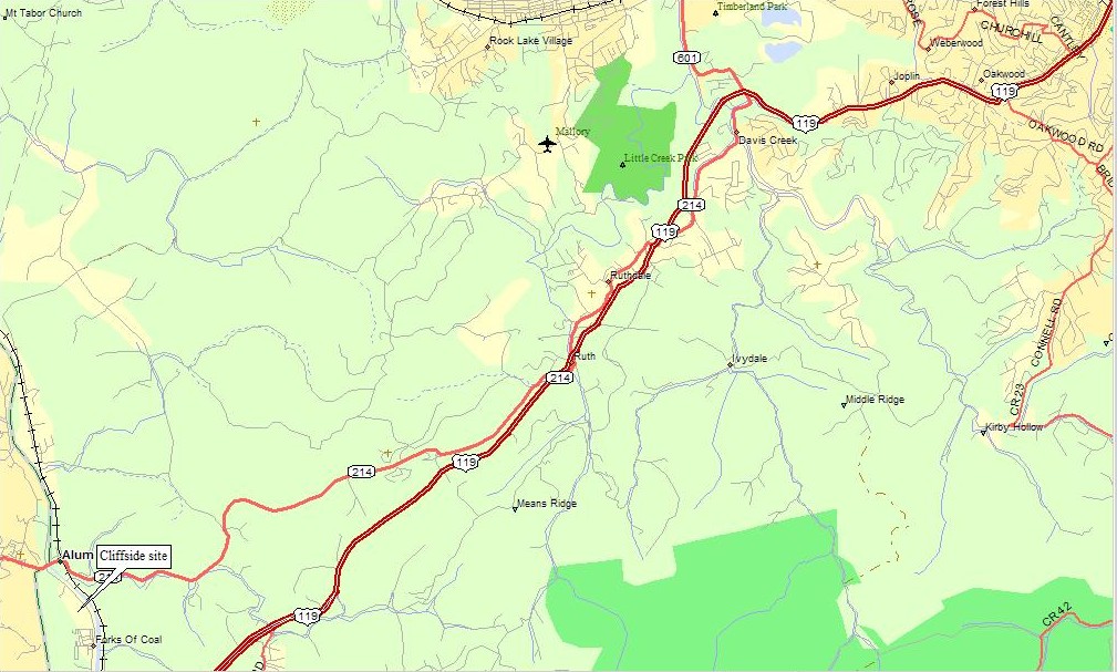
"File Footage" for reference. A map of the route to the Cliffside site off US Route 119, south of Charleston, WV. there is a neighborhood there now (2008) with some Cliffside buildings still visible, but please don;t disturb the current residents. On the map, "Forks of Coal" is about where the infamous "double bridges" are, crossing...well...the two Forks of the Coal River.
Yes, the map is big, but things on it get lost if it gets squeezed much.