Camelot1957aCropPrelim.jpg The waterfront, castle, tennis courts and softball field, and the walkway toward the rifle range are visible. Also the corral. |
Carlisle1957CropRtPrelim.jpg Again, details of playing fields, buildings, rifle range, corral and the swimming area are visible. |
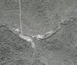
Cliffside1957aPrelim.jpg This is the way I remember it; a lot of open space; I think the campfire circle isvisible on the hill behind the row of small cabins housing the CITs, nature den, etc. Gym, mess hall and craft shop are clearly visible, as is the "bugle house"! Note the rifle range at the top of the picture, off the end of the cabin row. |
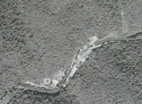
Cliffside1990CropPrelim.jpg Well, camp is closed, and the development begins. The cabins and other camps buildings are still visible, but being crowded. Look to the bottom of the picture for the infamous double swinging bridges across the forks of the Coal River! |
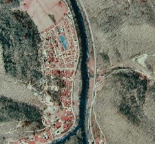
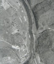
Cliffside1996CropPrelim.jpg Things are clearly out of hand. The development is overrunning the old camps buildings. The gym and craft shop are gone, but I can still pick out the cabin row. |
use the "Previous" and "Next" links on the enlargement to move quickly to later or earlier years. The effect is striking. (We'll improve the registration when time permits.) |