|
|
|
| Jim O'dell sent some links and information on current (2010!) use of the old Blue Creek rail lines. | Jim O'Dell Rail Link |
|
Click to enlarge 1907 topo |
Please
share your memories, in photos or words -- The Creek keeps changing,
and we want to capture what we can.
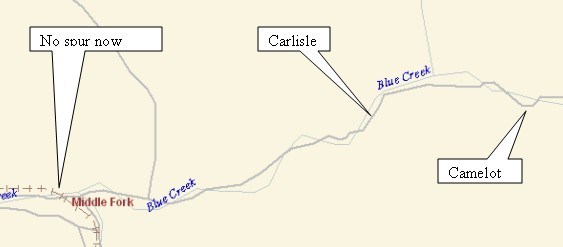
For example: Does anyone remember the walk-in ifrom those older days? Did we actually walk all the way from the trestle to Carlisle and on to Camelot? So far, we've been unable to uncover much evidence of a rail line from that period further east from Middle fork up the creek toward the camps. Maybe it was never there. |
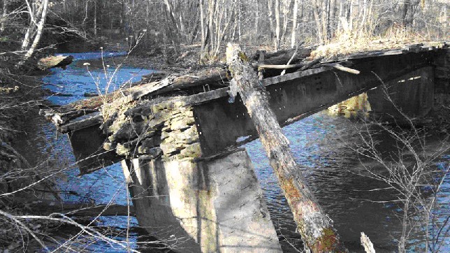
| As campers and staff, many of us rode the rails from the old New York Central station in West Charleston, up the Elk River, through Coonskin Park to Quick and then up Blue Creek toward Carlisle and Camelot. The passage of time has erased the station (now the Capitol Market) and much of the rail structure, but Elk River and Blue Creek Rails-to-Trails efforts are underway (2007-8) and some roadbed has already been converted at Middle Fork (near the trestle just downstream of Carlisle). |
Click to enlarge |
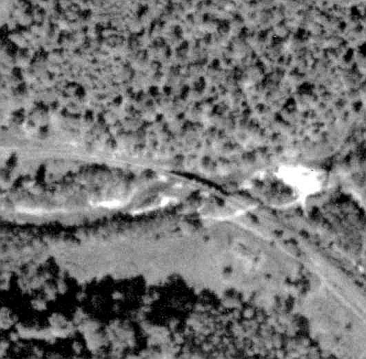
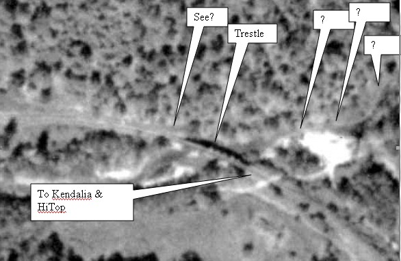
| At Middle Fork, the rail line coming east from Elk River turns South toward old mines at HiTop and toward what we now call Kendalia. It looked from the pictures that a spur might once have run toward the east from just north of the trestle (center of picture -- Elk River and Quick to the left, camps to the right). |
 .... ....
Click to enlarge |
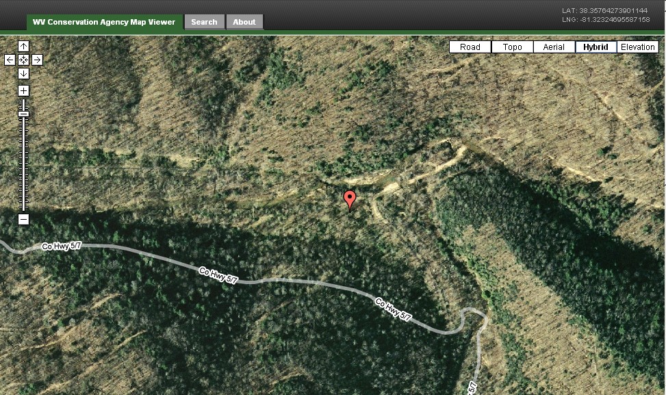
| Another view of the "Middle Fork Curve" is available using the West Virginia Conservation Agency aerial photograph and map viewer. "The trestle" downstream of Carlisle is just to the northwest of the stick-pin icon in the center. |
Click picture to enlarge (copyright 2009 Tele-Atlas) |
Click to enlarge |
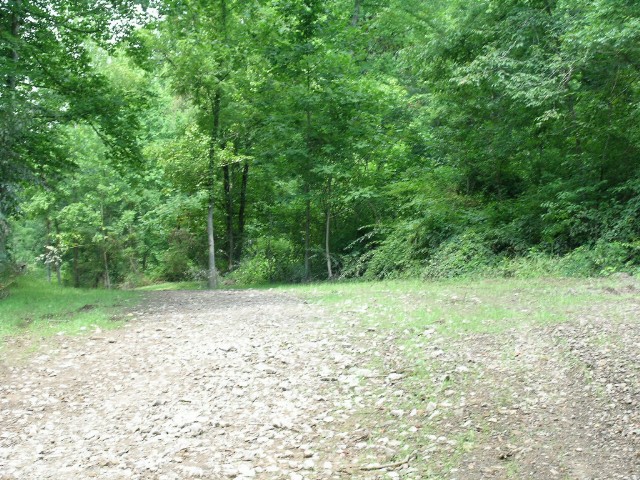
A 2007 visit to that trestle showed that such an eastern spur was unlikely. If a spur existed, it might have run from a point south of the trestle. The picture, of course, cannot show all that was visible from the site. We're still looking. |
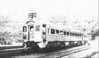
Click for more RDC literature |
There was an earlier train (steam, likely?) but by the mid 50s, the "Budd RDC" diesel-powered car was used. It's easy to remember that very rural trip up the river and through the woods, past Quick (the camps' post office back then) and on into our magical Neverland. At the time, it seemed we were in another galaxy far, far away. It's always a surprise to realize just how close to the city we were! |
| We're continuing to do research on old aerial photos and maps, and we've hiked and searched the areas between Middle Fork and the camp sites to find relics or evidence from the camps days -- or maybe just find some memories. |
Click to enlarge |
Click to enlarge |
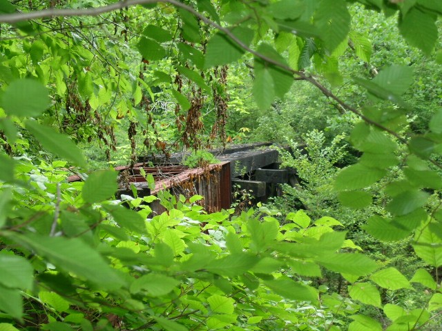
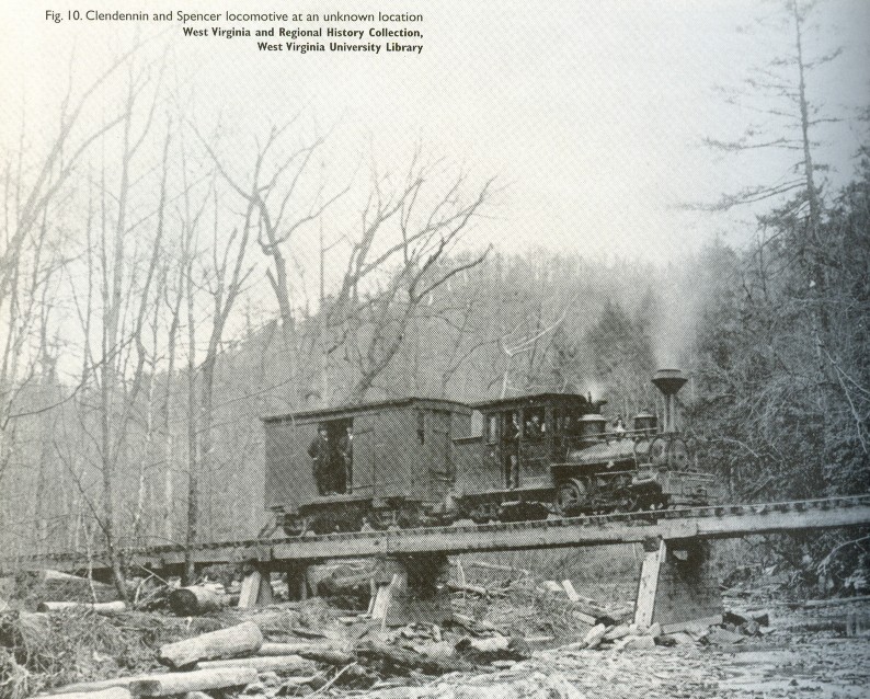
Here is a Randy Rice picture of an old trestle across the creek upstream from Carlisle, Camelot and Galahad/Joshua Scott locations (on the way to the Hunting-fishing Club). Was it an old railroad bridge? We're still looking. |
Click to enlarge |
Actually, the bridge shown here looks remarkably like the one above...coincidence? The only information I found on Clendenin and Spencer Railroad was from the 1890s. |
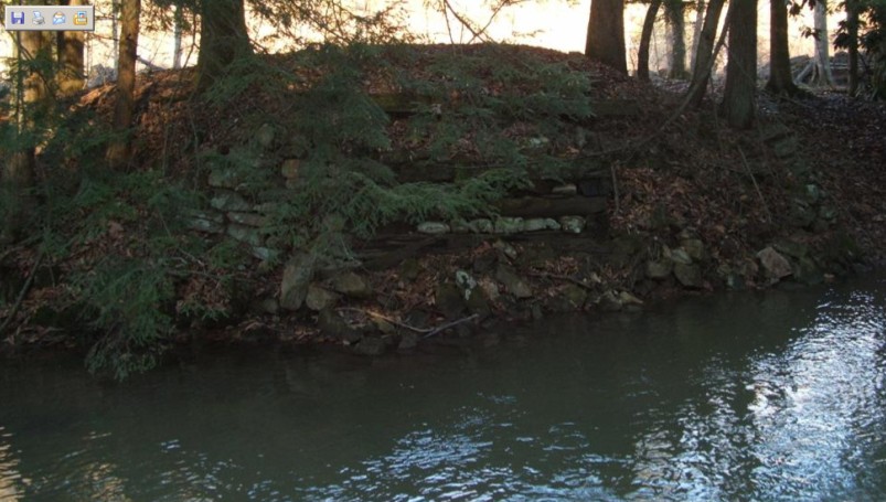
| Tantalizing, but unproven: Here is an appparent abutment structure from rock and timber, at the edge of the creek just downstream of the Camelot stables site. Could it have been one end of a rail trestle? Or perhaps it is just a road bridge from the old road, now repositioned to the south of the creek all the way between the Camelot site to Carlisle sites. |
Click to enlarge |